
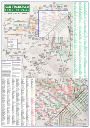
This map shows all street railway lines in San Francisco, past and present, deliniated by mode of propulsion (horse, cable, steam or electric). The date of opening and closing of each segment of line in the city is provided – this is the only comprehensive map of this type produced for a US city, and follows the same basic format as my Melbourne and Sydney tram maps, though of course open cable lines are depicted!!
Leave a Reply